The first Spanish Earth observation satellite will be shipped next month to Vandenberg/USA ready for launch on a Falcon 9 on 30 January 2018
The high-resolution PAZ radar Earth observation satellite is set for shipment to its launch site in Vandenberg Air Force Base, California, in December 2017.
Airbus, PAZ prime contractor, and Hisdesat, the Spanish operator of governmental satellites, say that the launch of the PAZ satellite will take place in the last week of January. Launch was initially scheduled on a Ukrainian-Russian Dnepr in 2015 but was switched to the Falcon 9 in the face of repeated delays.
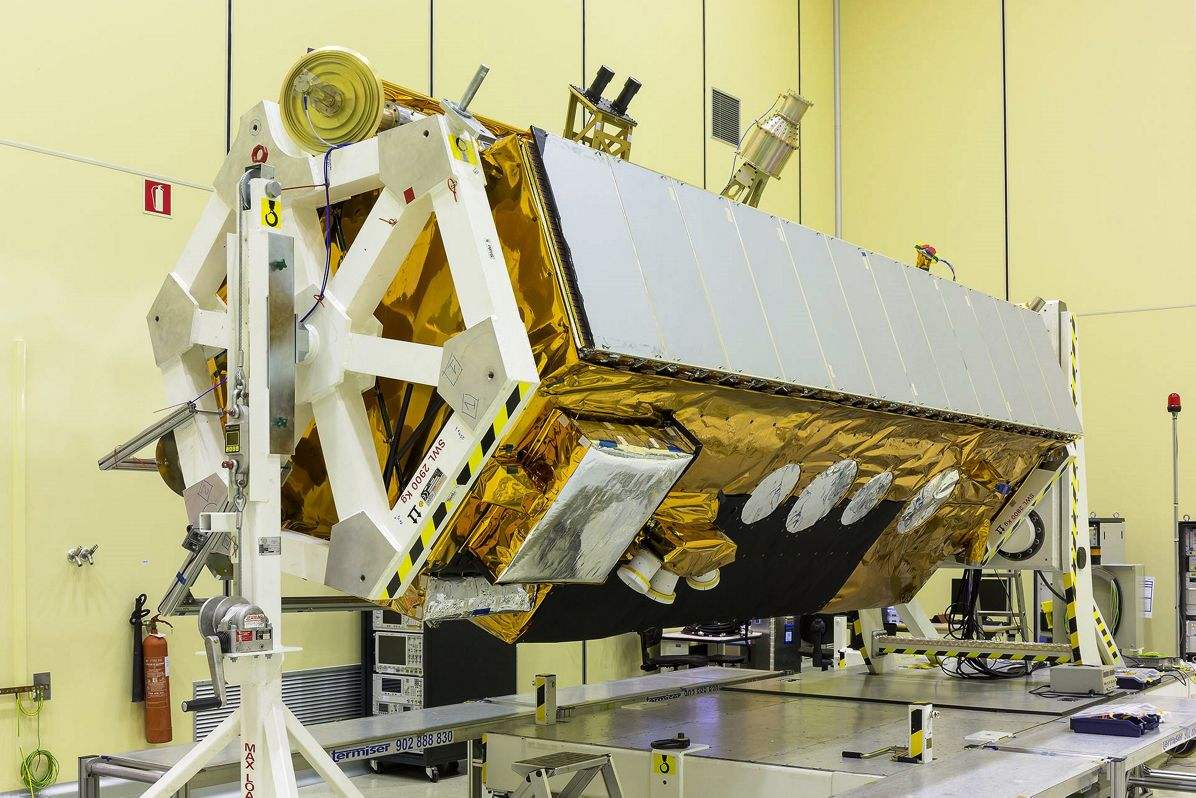
Since its completion in 2015, the satellite — intended primarily to address civilian surveillance needs — has been maintained in the manufacturer's Barajas cleanrooms, in Madrid, ready to be launched at short notice.
The PAZ satellite is equipped with an advanced radar instrument designed for high flexibility, and the capability to operate in numerous modes allowing for the choice of several different image configurations. It will be able to generate images with up to 25cm resolution, day and night and regardless of the meteorological conditions.
Designed for a mission of five and a half years, PAZ will orbit Earth 15 times per day, covering an area of over 300,000km2 from an altitude of 514km. On its slightly inclined quasi-polar orbit, PAZ will cover the entire globe in 24 hours, serving both government and commercial needs.
PAZ also features an Automatic Identification System (AIS), simultaneously combining for the first time ship AIS signals and SAR (Synthetic Aperture Radar) imagery, increasing the monitoring capacities of the maritime domain worldwide.
It will also be equipped with a Radio Occultation and Heavy Precipitation experiment (ROHP) from the Institute of Space Science del Consejo Superior de Investigaciones Científicas (ICE-CSIC). For the first time, GNSS (Global Navigation Satellite System) Radio Occultation measurements will be taken at two polarizations, to exploit the potential capabilities of polarimetric radio occultation for detecting and quantifying heavy precipitation events.
Once in space, PAZ will share the same orbit as the TerraSAR-X and TanDEM-X radar satellites. The three platforms will be operated as a very high-resolution SAR satellite constellation. The addition of this third satellite will reduce revisit time and increase acquisition capacity, leading to subsequent benefits for various applications. All three satellites feature identical ground swaths and acquisition modes. The new setup will be jointly exploited by Hisdesat and Airbus.
PAZ will also be a contributor to Copernicus, the European Global Monitoring for Environment and Security programme.