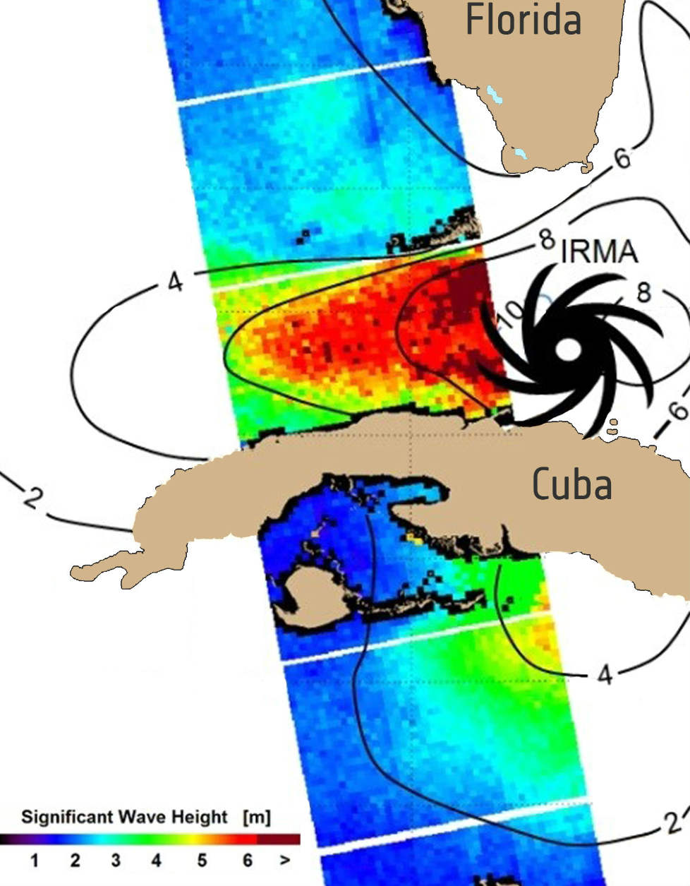
Scientists at the German Aerospace Centre have developed a technique that allows the satellites' radar to probe sea surface wind and wave heights.
Scientists have found a new role for Europe's Sentinel-1 satellites: probing through hurricanes to monitor the state of the sea surface below.
Sentinel-1A and Sentinel-1B — launched in 2014 and 2016, respectively — are in the same 700km orbit, spaced 180° apart. They provide radar images for Europe's Copernicus environmental monitoring programme.
Information from the mission is used for numerous applications, from monitoring sea ice and marine oil spills to mapping floods and land-surface deformation caused by earthquakes. But not, until now, for observing hurricanes.
Unlike satellites that carry optical instruments, from which we get the familiar images of the top of hurricanes, radar can penetrate clouds to image the sea underneath the weather systems.
Taking Sentinel-1 beyond its original scope, scientists at the German Aerospace Centre have developed a technique that allows the radar to probe sea-surface wind and wave heights. This information about the state of the sea can help to assess how destructive a hurricane is and predict its path – and, therefore, where and when it is likely to make landfall.
The same information can also be used to warn ships and to issue warnings of coastal flooding.
This new technique was used for the first time when hurricane Irma struck Cuba and the Florida Keys in early September (see image above).
Sentinel-1 works in several different modes, but its ‘wide swath mode’, which is 250km wide with a resolution of 5 x 20m, is particularly valuable for understanding ocean waves.
This is especially important because in situ measurements of wind and sea state cannot be gained from buoys or dropped probes in such extreme weather or over such a wide area.

