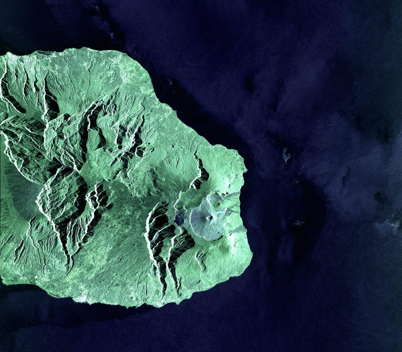
The European Space Agency (ESA) has unveiled the first Sentinel-1 satellite images sent via the European Data Relay System (EDRS). The two images were taken by the radar on the Copernicus Sentinel-1A satellite over La Reunion Island and its coastal area. The first (above) was scanned in a high-resolution "Stripmap" mode, the second (left) in "extra wide swath" mode that provides broad coverage of waters around the island (at top right of image) and is used in particular for maritime surveillance.
Sentinel-1A transmitted the images to the EDRS-A node in geostationary orbit via a laser beam at 600 Mbit/s. The laser terminal is capable of working at 1.8 Gbit/s, allowing EDRS to relay up to 50 TB a day. EDRS immediately beamed the data down to Europe. The transfer between the two satellites was fully automated: EDRS connected to Sentinel from more than 35,000km away, locking on to the laser terminal and holding that link until transmission was completed.
The German Space Operations Center in Oberpfaffenhofen, Germany, tasked by the Mission Operating Center of Airbus Defence and Space in Ottobrunn, received the raw Sentinel-1A data at its station in Weilheim, Germany. They were then passed to the ESA-managed Sentinel-1 ground segment, where they were processed to generate the final products.
EDRS promises improved access to urgent and potentially life-saving coverage from space, allowing access to time-critical data acquired around the world. EDRS will also boost operational monitoring services like maritime surveillance by relaying the data as quickly as possible to Europe, thanks to its network of ground stations.
The SpaceDataHighway is a public–private partnership between ESA and Airbus Defence and Space. The DLR German Aerospace Centre funded the development of the cutting-edge laser technology that forms the backbone of the system. The first node, EDRS-A, was launched on 29 January 2016 as a hosted payload on the Eutelsat-9B satellite. The second, the dedicated EDRS-C satellite, will be launched in 2017.
The European Commission’s Copernicus Sentinel satellites are the first users of the EDRS service. ESA is planning the GlobeNet programme to extend EDRS by 2020, providing additional security services to satellites, aircraft and drones.
The laser communication technology used today will be able to bridge up to 75,000km, sending data from one node over the Asia–Pacific region (EDRS-D) to another over Europe (either EDRS-A or EDRS-C). This global coverage will provide quasi-realtime services around the world linking instantaneously back to Europe.